Marine Rules & Signals
- Категория: Navigation
- Дата выхода: 2009-05-15
- Текущая версия: 3.2
- Adult рейтинг: 4+
- Размер файла: 27.61 MB
- Разработчик: Imray
- Совместимость: Требуется iOS 8.0 или выше.
- Кол. оценок: 1
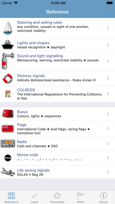
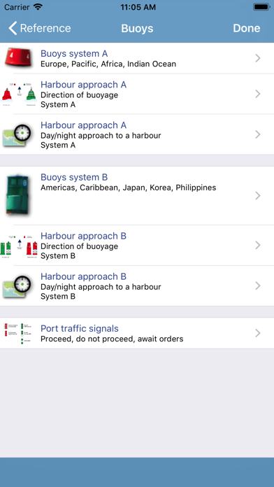
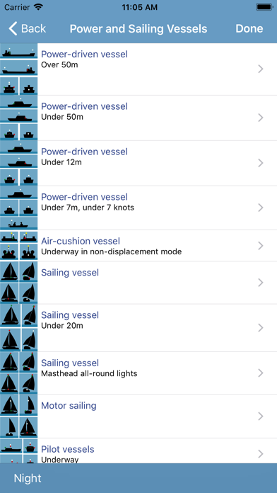
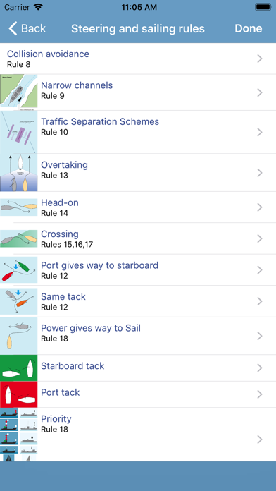
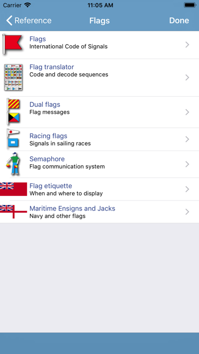
The reference guide to rules and signals at sea. Part of a series of Marine Navigation apps, Rules & Signals is a useful tool for sailors, fishermen, surfers and people involved in sea water sports. The Imray Marine Navigation reference products are intended for quick reference and learning. Beautifully illustrated with diagrams and short, clear text. Remind yourself quickly about a rule or light, or learn at home, traveling or in the winter while planning your trips. INCLUDES RULES OF THE ROAD: - Steering and sailing rules. - Lights and shapes: day and night time marking of boats. - Sound signals in restricted visibility. Actual sounds. - Distress signals. - Full Colregs text. SIGNALS & COMMUNICATION: - Buoys: worldwide buoyage systems A & B and animated harbour approaches. - Buoy lights, animated. - Sample harbour charts from around the world, with animated lights. - Flags: flag translator, phonetic alphabet, morse code and message builder. - Dual flag messages. - Racing flags. - Semaphore flags. - Radio calls including Mayday/PanPan and radio channels. - Life saving communication including air rescue: Solas V. - Communication with air rescue. LEARNING SYSTEM: - Learning cards for all content, by section or for all Rules together. Content can be scrolled, viewed individually or in sequence. Large images (charts and at a glance images) can be zoomed and panned. Based on the International Regulations for Preventing Collisions and Sea, 1972, with amendments in force from November 1995, SOLAS Chapter V Regulation 29 and the general guidelines for buoys and signals. LANGUAGES English, French, German, Italian, Spanish, Japanese ABOUT US Imray are a leading chart and marine book publishers, based in England and with a catalogue of charts that covers Europe, the Mediterranean and the Caribbean. Imray's pilot books cover the whole world in extensive detail. In partnership with Imray, software developers and sailors. Follow us on Twitter - http://twitter.com/imray_charts Facebook - imraynautical Look out for other applications in the Marine Navigation Series from Imray: TIDES PLANNER - tide predictions any date MARINE CHARTS - Europe Atlantic, Mediterranean, Caribbean, Australia BOAT INSTRUMENTS & AIS (requires WiFI NMEA bridge) CHART SYMBOLS