GIS Pro
- Категория: Navigation
- Дата выхода: 2011-10-15
- Текущая версия: 3.31
- Adult рейтинг: 17+
- Размер файла: 43.53 MB
- Разработчик: Garafa, LLC
- Совместимость: Требуется iOS 9.0 или выше.
- Кол. оценок: 1
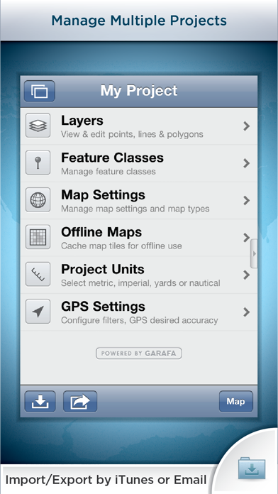
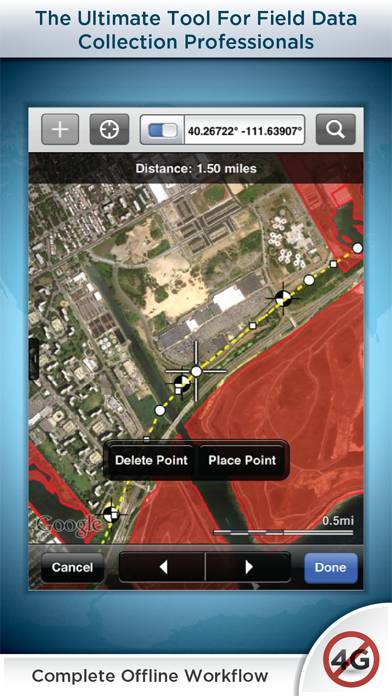
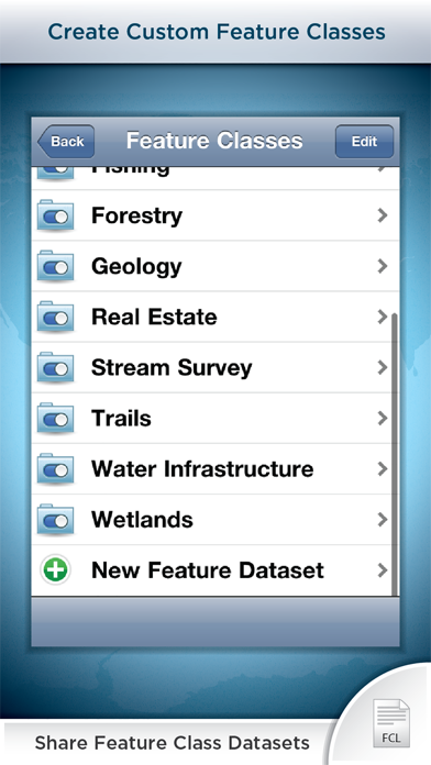
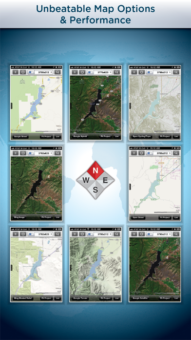
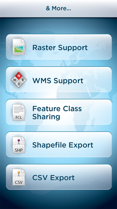
Premier field collection and data viewer for iPhone and iPad. GIS Pro is the enterprise version of a two part app suite for mobile GIS users. GIS Kit ($99) is geared toward individual users whereas GIS Pro ($299) is capable of some more advanced, collaborative features that are typical of an enterprise environment (see list below). FEATURES IN GIS KIT & GIS PRO - No desktop GIS software required. - No prior GIS training required. - Completely offline capable. - Cache (download) open source topographic maps, street maps and satellite imagery straight from device. - Import ESRI Shapefiles and KML/KMZ files including attributes. - Attribute/form fields include: Alphanumeric (Description), Photos, numerical values, user defined list of values, addresses, websites, date & time, telephone number, check box. - Easily collect new point, line, and polygon features in the field by GPS or drawing manually. - Enter attribute values for each feature and/or add new attribute types at time of collection. - Create templates of user defined feature classes with custom attributes. - Comes loaded with numerous example feature templates for professional use in Forestry, Wetland Delineation, Stream Surveys, and Real Estate. - Import and export data wirelessly by email. Larger data sets can be imported/exported by connecting to any computer with itunes. - Filter the GPS based data collection by controlling the amount of GPS points by distance, time or accuracy - Organize by projects and layers - Best-in-class performance. Tested on iPad 2 with over 1 million point features! FEATURES ONLY IN GIS PRO - Raster imagery import & export (GeoTIFF, Worldfile, KML, and even non-spatially referenced images can be imported with in-app 3-point registration) - Export Shapefiles and CSV files via email or USB with iTunes - Export, share, and import custom feature class templates with other devices used by your team so there are no conflicts with your features and their attributes. - Basic WMS for additional basemap options - Easily convert Shapefiles to KMZ files and vice versa Documentation and videos can be found using the support link. IT MANAGERS Please note that a separate license is required for each user or each device that is used by multiple users. See http://www.apple.com/legal/itunes/us/terms.html for details. Also see http://www.apple.com/business/vpp for information on purchasing in volume. Continued use of GPS running in the background can dramatically decrease battery life.